Wednesday, April 29, 2009

Commission Acts on Norway's Arctic Ocean Extended Continental Shelf Submission, Accepts Somalia's Preliminary Information

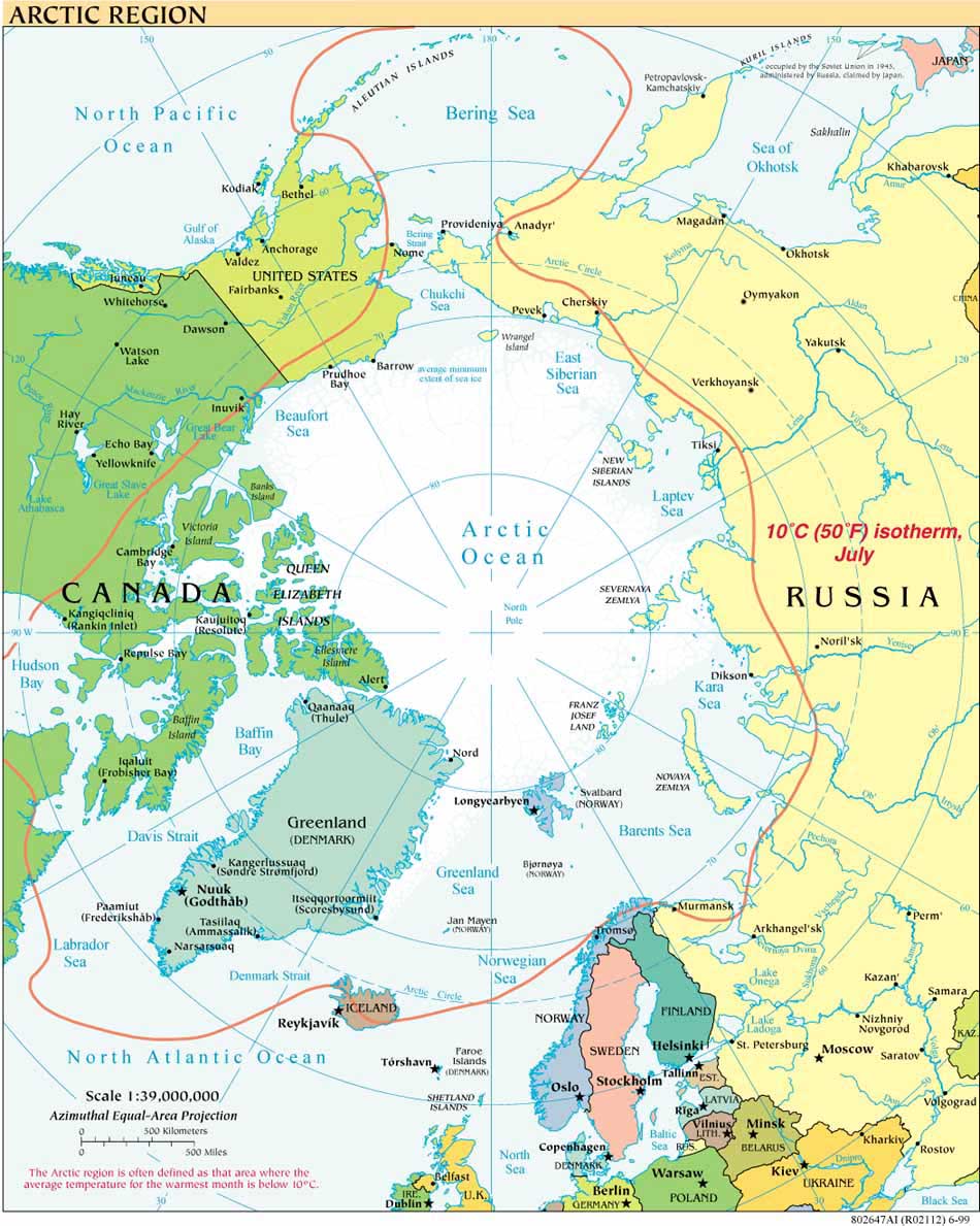
On April 15, 2009, Norway announced the favorable review of its submission regarding the Arctic Ocean extended continental shelf by the Commission on the Limits of the Continental Shelf (CLCS).  The CLCS has issued its final recommendations on the Norwegian submission under Article 76 of the Law of the Sea Convention, but these are not yet available on the CLCS website list of recommendations.  The CLCS recommendations cover Norway's submission with respect to the Barents Sea, the Arctic Ocean and the Norwegian Sea.

Russia was the first arctic state to make a submission to the CLCS regarding the [Central] Arctic Ocean, in 1997. However, in 2002 the CLCS "recommended that the Russian Federation make a revised submission in respect of its extended continental shelf in that area based on the findings contained in the recommendations." A/57/57/Add.1, Oceans and Law of the Sea, Report of the Secretary General, 2002, para. 41.

Norway also played a key role in supporting Somalia's April 8, 2009, submission of Preliminary Information indicative of the Outer Limits of its Continental Shelf to the CLCS. With Norway's technical assistance, Somalia became one of the first African countries to take advantage of the "preliminary information" filing option, adopted in June 2008, to help numerous developing countries meet their May 2009 filing deadline with the Commission.  As noted in the Norwegian Goverment's press release, the submission was prepared in consultation with the Secretary General's Special Representative for Somalia acting on behalf of the Transitional Federal Government of the Somali Republic and with "the assistance of international law experts in the Norwegian Ministry of Foreign Affairs, experts in the geosciences in the Norwegian Petroleum Directorate and experts from the UNEP Shelf Programme, represented by GRID-Arendal."

Somalia's two decades of civil war have engendered great suffering for its population and now allows piracy to thrive off its shores.  It has continental Africa's longest coastline, at 3,025 kilometres (1,879.64 miles).

Ministerial Meeting of Arctic Council in Tromsø

In conjunction with the Ministerial Meeting of Arctic Council, convened today, April 29, 2009, in Tromsø, Norway, Deputy Secretary of State James Steinberg has laid out avenues for cooperation between the United States and other Arctic Council member states. Making special reference to the differing U.S. and Canadian positions on the Northwest Passage he indicated that the two countries could "work through" their differences. He also highlighted the opportunity for new forms of cooperation with Russia. The agenda and related documents for the Ministerial meeting can be accessed here.

Although the EU is seeking permanent observer status at the Arctic Council, the EU Commission decided not to send Commissioners in any official capacity to this year's Ministerial meeting. Canada is opposing EU observer status in part because of a ban on imported seal products expected to be passed by the European Parliament next week. The Commission's Communication on the EU and the Arctic Region, COM(2008) 763 final, published in November 2008, generated criticism from some arctic states, one unattributed source querying how Europeans would react were, say, Canada to issue a policy statement on the Mediterranean.

Other voices have recognized Europe's interest in the Arctic not only by virtue of the fact, as the Communication states, that "three EU member states Denmark (Greenland), Finland and Sweden — have territories in the Arctic [and t]wo other Arctic states — Iceland and Norway — are members of the European Economic Area." One such voice is Jessica Shadian who, writing in Canada's Policy Options, and elsewhere, acknowledges Europe's interests in the Arctic yet concludes that the "ultimate authorities" over the future course of the Arctic must be "the Arctic nations and the Arctic’s indigenous peoples."

POSTSCRIPT:
Actions taken at the Tromsø meeting included adoption of the long-awaited Arctic Marine Shipping Assessment.

Saturday, April 18, 2009

Healy, Mayer and CCOM in May 2009 National Geographic piece on Arctic Mapping

The summer 2007 mapping cruise of the USCGC Healy, and the meticulous and stunning work of Larry Mayer and the Center for Coastal and Ocean Mapping/UNH-NOAA Joint Hydrographic Center are featured in the May 2009 National Geographic article "Arctic Landgrab", by McKenzie Funk. Of particular note is Mayer's vivid and elegant image of multibeam sonar tracks gathered on Healy mapping cruises from 2003-2008. Mayer was also one of five consultants for the issue’s remarkable pull-out map of the Arctic Ocean, together with Kelley Brumley (University of Alaska Fairbanks/Stanford), Elizabeth Miller (Stanford University), Martin Pratt (University of Durham International Boundaries Research Unit) and Peter Vogt (UC Santa Barbara).  The map is available with the May issue at newsstands but not yet online.  Detailed study of just this one map reveals much about the relatively little that is known about the geomorphology and bathymetry of the Arctic Ocean.  A comparison to earlier maps provides an even clearer sense of how rapidly knowledge of the Arctic Ocean is changing, see, e.g. the 2008 International Bathymetric Chart of the Arctic Ocean and the 1975 Bruce Heezen/Marie Tharp map of the Arctic Ocean Floor.  National Geographic makes an earlier geophysical map of the Arctic Ocean, from its 2002 atlas, available online here.

The Mare Glaciale region, some 440 years ago
Map of the North Atlantic region, Sigurdur Stephansson (1570), published in The Geology of North America, Vol. L, The Arctic Ocean region, The Geological Society of America, 1990, p. 7.

For one history of Arctic Ocean bathymetry through 1983 see  J.R. Weber, Maps of the Arctic Basin Sea Floor:  A History of Bathymetry and its Interpretation, in: Arctic, vol. 36, no. 2 (June 1983), pp. 121-142.


Icebreaking into the Arctic

The USCGC HEALY embarked Barrow, Alaska, in August 2008 to map the US extended continental shelf, or ECS, in the Arctic Ocean (HLY 0805). Healy sailed again from 7 August to 16 September, 2009 (HLY 0905) to continue ECS mapping, joining with the Canadian icebreaker, the Louis S. St.-Laurent. The two vessels mapped together again in 2010 (see HLY1002) and 2011 (HLY1102).

As the only law professor on the science crew, I was along on HLY 0805 and 0905 to better understand
the science behind the legal process that the UN Convention on the Law of the Sea establishes for states making ECS submissions. As to why the US is mapping now, even though it has not yet acceded to the Convention, read on both here, and in the Law of the Sea notes below.

Thanks to
Vermont Law School and especially to Larry Mayer, Director of the University of New Hampshire's Center for Coastal and Ocean Mapping, for making my part in the trip possible.
Thanks, as well, to Adriane Colburn, for opening new windows on and for the deep.