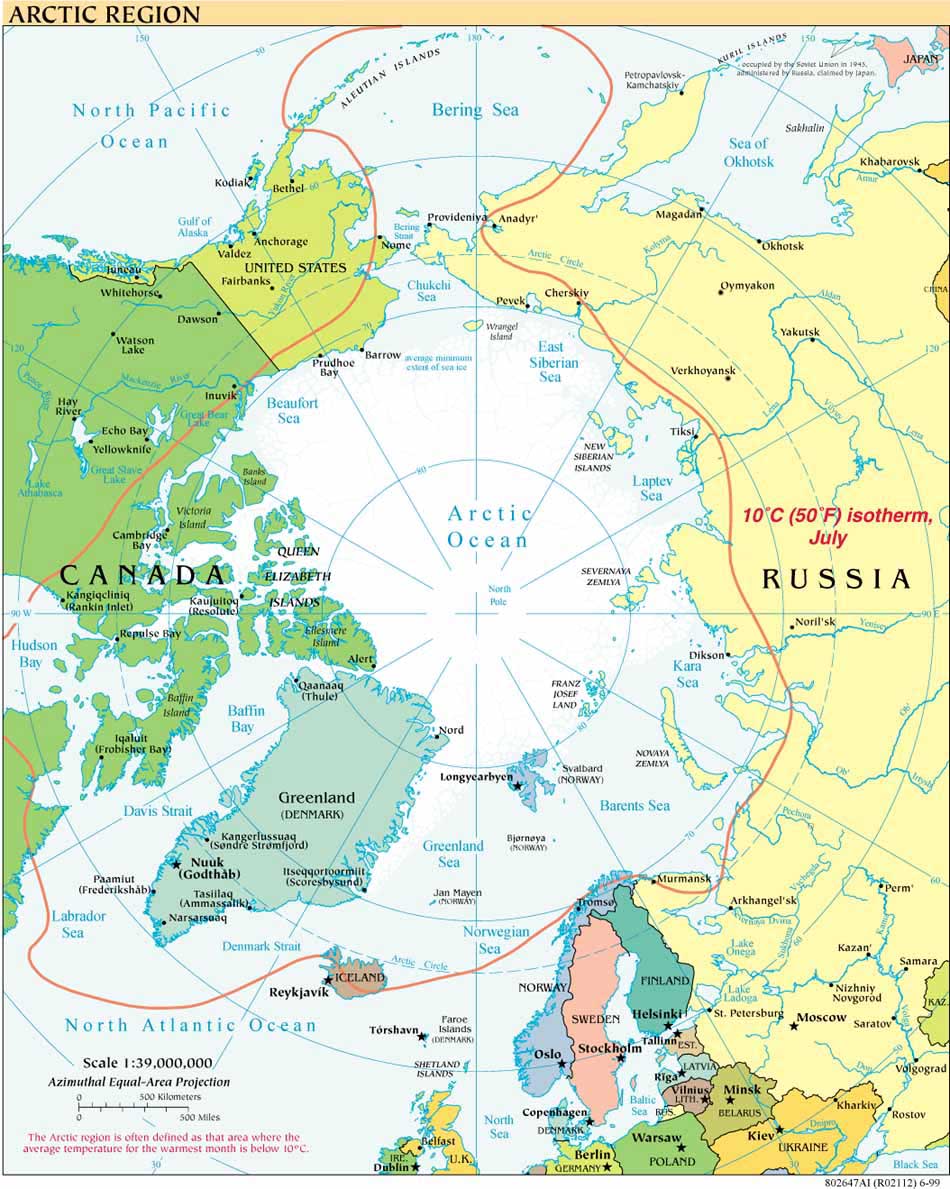
As is clear from following the links to the right of this blog post, the USCGC Healy has been in the Arctic Ocean for several weeks on its “Law of the Sea Extended Continental Shelf” mapping cruise. This is the fifth year that Healy is working jointly with the Canadian Coast Guard icebreaker Louis S. St. Laurent, collecting data to inform the eventual submission of reports to the Commission on the Limits of the Continental Shelf.
The Research Vessel (R/V) Marcus G. Langseth embarked September 8, 2011, from Dutch Harbor, Alaska, on a different kind of arctic mapping cruise.
As explained on the Langseth Chukchi Edges Project website, “The primary purpose of this cruise is to collect Multi-Channel Seismic Reflection (MCS) data across the transition from the Chukchi Shelf to the Chukchi Borderland.” One purpose the data will serve is to provide imaging of the transition between these two continental blocks, thus helping to narrow down when and over how long a period the two blocks were in relative motion with each other. That information is key to understanding the geological history of the area.
As the project's chief scientist, Dr. Bernard Coakley from University of Alaska-Fairbanks, explains:
“The geological history of the Amerasian Basin is poorly understood, in part due to the lack of identified plate boundaries. These boundaries must exist to explain the basin history. Identification of these structures will make it possible to reconstruct the development of the basin, which will substantially improve our understanding of the surrounding continents.”
R/V Langseth is operated by Lamont Doherty Earth Observatory (LDEO) at Columbia University. The Langseth is not an ice-strengthened vessel and this is the first time it has been used in the Arctic open water season (for more on the expected ice environment for the cruise, see the cruise website. LDEO has an office devoted to Marine Mammal Protection and Dr. Coakley has worked closely with NOAA to obtain the necessary permits for MCS activity. Community Observer Reynold (RJ) Aveoganna is part of the international team working with Coakley, which includes scientists from Korea, Germany, Turkey, the United States and the United Kingdom, representing seven different universities and research organizations.
The Langseth is scheduled to return to Dutch Harbor on October 10, 2011. Coakley will be blogging for the New York Times Scientist at Work feature throughout the cruise, beginning with today's post under Notes from the Field; subsequent posts will be available here.


