Wednesday, July 29, 2009

Canada and the United States announce details of joint Louis-Healy mission

The Canadian Ministries of Foreign Affairs, Natural Resources and Fisheries and the U.S. Department of State, Office of Ocean and Polar Affairs, have released the details of the joint icebreaker mission to map portions of the Arctic Ocean continental shelf (reported on in last week’s entry).  See the State Department announcement and reports of the Canadian statement. 

Canadian Minister of Foreign Affairs Lawrence Cannon, Minister of Natural Resources Lisa Raitt and Fisheries Minister Gail Shea all emphasized the exceptional partnership between the two countries, Shea also touching on the millions of dollars each country saves by working together on mapping the Arctic Ocean.

Readers who also subscribe to Caitlyn Antrim’s Ocean Law Daily will already know of the new Canadian Northern Strategy report and supporting website, launched this month.

Press reactions are already flowing in on both the joint mapping details and the Northern Strategy.  Not suprisingly, the Canadian press is devoting much more attention than its U.S. counterparts to these developments.  The New York Times report ties the mapping story to the Obama administration’s desire to ratify the Law of the Sea Convention.   

Arctic Shipping:  Also in the NYT (DotEarth blog) this week are reactions to Andrew Revkin's story about Trans-Arctic shipping.  Traffic is increasing, as documented formally by the Arctic Council's AMSA (Arctic Marine Shipping Assessment 2009) as well as anecdotally.  According to an audio report from Alaska Public Radio Network, as transmitted by the Top of the World Telegraph, the waters off of Barrow, which has no deepwater port, are crowded this week:  "At least one icebreaker and three sailboats attempting to navigate the Northwest Passage have been anchored off of the northern city while crews stock up on supplies."  The Telegraph is prepared by  the Anchorage-based Institute of the North, which was also integrally involved in AMSA.

Saturday, July 18, 2009

Canadian and U.S. Icebreakers Poised for Joint UNCLOS Mapping of Arctic Ocean

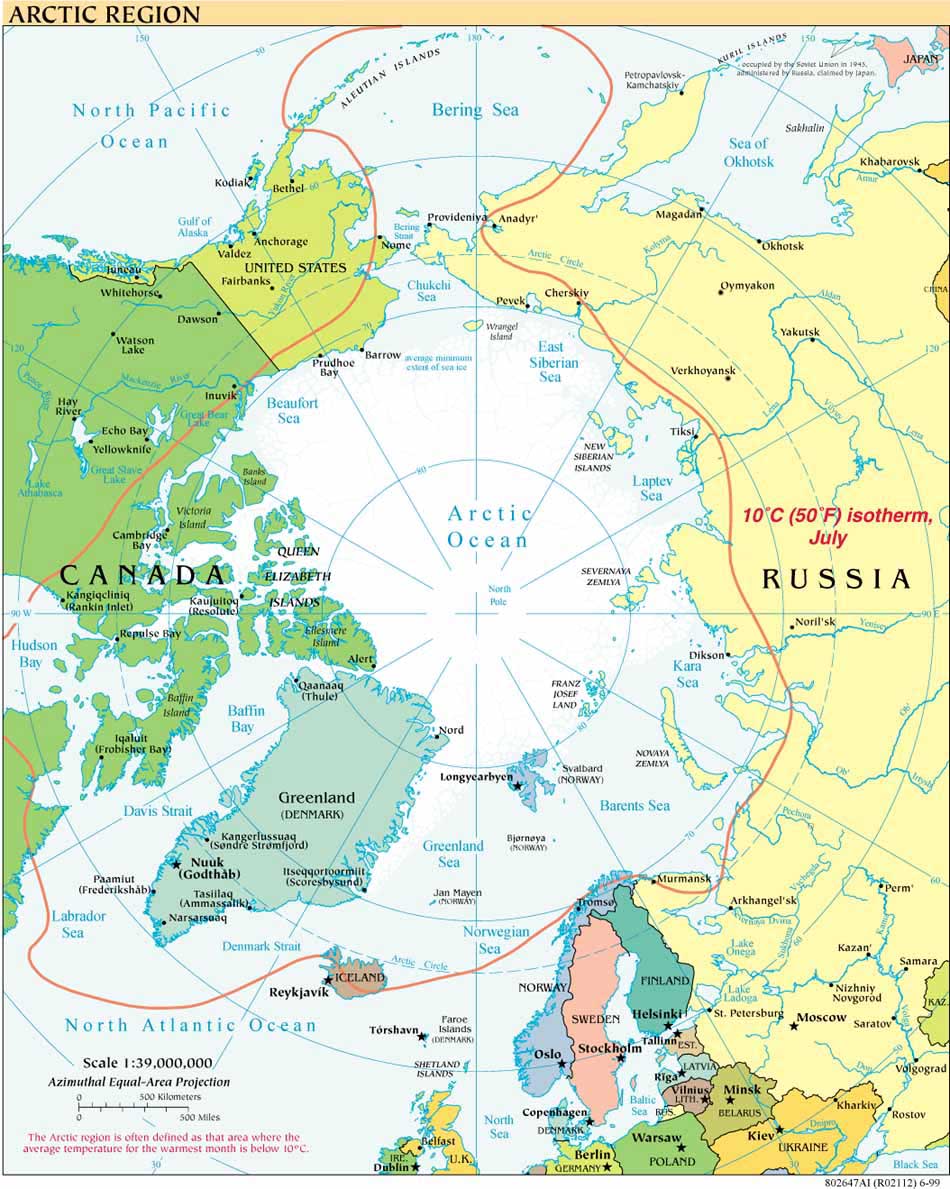
The Canadian Coast Guard Cutter Louis S. St-Laurent is scheduled to embark Halifax, Nova Scotia, on Monday, July 20, en route to an early August rendezvous with the U.S. Coast Guard Cutter Healy (WAGB-20) in the Arctic Ocean.  There the two vessels will begin their second joint Canadian-United States mission to map the Arctic Ocean under the process established by Article 76 of the UN Convention on the Law of the Sea (UNCLOS).  The Healy left its home port of Seattle earlier this month and is currently (July 18) transiting from the Gulf of Alaska along the Aleutian Peninsula to the Bering Sea.

Both ships can be tracked online, the Louis here and the Healy here.

Accounts of the 2008 joint cruise are available from the U.S. Geological Survey (Jon Childs and Deborah Hutchinson) and the U.S. Coast Guard (Captain F.J. Sommer), and in academic publications (e.g. Eos, D. Hutchinson /H.Ruth Jackson et al). A complete Cruise Report (Larry A. Mayer and Andy Armstrong) from the Healy 0805 solo cruise just prior to meeting the Louis in 2008 is available from the Center for Coastal and Ocean Mapping/Joint Hydrographic Center at University of New Hampshire (CCOM/JHC), as is data from all CCOM/JHC Law of the Sea cruises.  The two countries work together on mapping while abiding by their different approaches to how much of the data can be made public; some have called for Canada to return to greater transparency with respect to its seafloor data.

The 2009 Cruise Plan for the Healy component (0905) of this year’s joint cruise is available from Icefloe.net, as is the Joint Healy-Louis Science plan for last year’s cruise.  Natural Resources Canada provides an excellent overview of the Canadian UNCLOS Bathymetric Mapping Program prepared by J. Richard MacDougall, Wendell Sanford and Jacob Verhoef for the Canadian Hydrographic Conference and National Surveyors Conference 2008.  Finally, an e-brochure recently published by the U.S. Minerals Management Service discusses the basics of the U.S. effort to map its extended continental shelf (a term of convenience, it should be recalled, that does not appear in the Law of the Sea Convention).

The Louis S. St-Laurent is named after Louis Stephen St. Laurent (1882-1973), who served as Canada’s Minister of Justice 1941-46 and Secretary of State for External Affairs 1946-48 before becoming Prime Minister of Canada in 1948, a post which he held until 1957.

The Healy is named after Michael Augustine Healy (1939-1904) the U.S. Coast Guard’s first African-American captain, who commanded several vessels that patrolled the vast waters off of the new Alaskan territory after its purchase from the Russian Empire in 1867.

Tuesday, July 7, 2009

Lavrov and Clinton to coordinate joint Russian-US Presidential Commission

The Barents Observer reported July 6, 2009, on the joint commission created by Presidents Medvedev and Obama as part of the latter’s visit this week to the Russian Federation. Russian Foreign Minister Sergey Lavrov and US Secretary of State Hillary Clinton will serve as Commission Coordinators, overseeing its 13 working groups. While the Arctic was not named specifically in either the Kremlin or White House Fact Sheets about the Commission, at least two working groups have the potential to address issues relevant to  arctic mapping and scientific cooperation.  The Energy and Environment Working Group will be headed by Sergei I. Shmatko, Minister of Energy, and Steven Chu, Secretary of Energy, and the Science and Technologies Working Group by Andrei A. Fursenko, Minister of Education and Science, and John Holdren, Director, Office of Science and Technology Policy. Mention of the Arctic was also notably absent from yesterday’s joint Medvedev-Obama Press Conference.

Given both countries’ emphases on the importance of scientific cooperation and/or continental shelf mapping in recent statements relevant to their respective interests in the Arctic  (the United States Arctic Region Policy of January 2009, "The fundamentals of Russian state policy in the Arctic up to 2020 and beyond"and the Russian Maritime Strategy, anticipated this summer), it is to be hoped that the Lavrov-Clinton Commission will also lead to new opportunities for scientists from both countries working together in the Arctic.

Update July 8:  In keeping with last week's entry, the Center for American Progress has pointed out that, contrary to misguided "land grab" perceptions, Russia is following agreed legal procedures in pursuing its continental shelf claims. The Center also integrates bilateral cooperation in the Arctic into its proposed new agenda and strategy for United States relations with the Russian Federation.

Also of note this week:

Also this week, USCGC HEALY embarked Seattle for the Arctic Ocean.  You can follow the ship’s missions for the rest of Summer 2009 as it supports such research as deployment of oceanographic moorings and whale hydrophones (0904), and continental shelf mapping with the Canadian Coast Guard’s Louis St. Laurent (0905).  As part of its Arctic West Summer cruise, the HEALY has already completed 2009 projects on the Bering Ecosystem.

On an (admittedly) unrelated but timely note about scientists in the Arctic, your blogger begs her readers’ indulgence in pointing them to a recent arctic tribute  from researchers at Toolik Lake Field Station to a cultural icon, as well as information about GIS and other projects at this University of Alaska-Fairbanks research station.

Icebreaking into the Arctic

The USCGC HEALY embarked Barrow, Alaska, in August 2008 to map the US extended continental shelf, or ECS, in the Arctic Ocean (HLY 0805). Healy sailed again from 7 August to 16 September, 2009 (HLY 0905) to continue ECS mapping, joining with the Canadian icebreaker, the Louis S. St.-Laurent. The two vessels mapped together again in 2010 (see HLY1002) and 2011 (HLY1102).

As the only law professor on the science crew, I was along on HLY 0805 and 0905 to better understand
the science behind the legal process that the UN Convention on the Law of the Sea establishes for states making ECS submissions. As to why the US is mapping now, even though it has not yet acceded to the Convention, read on both here, and in the Law of the Sea notes below.

Thanks to
Vermont Law School and especially to Larry Mayer, Director of the University of New Hampshire's Center for Coastal and Ocean Mapping, for making my part in the trip possible.
Thanks, as well, to Adriane Colburn, for opening new windows on and for the deep.