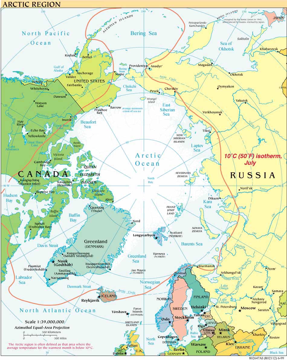
“The increased accessibility of the Arctic, with its energy and mineral resources, new fisheries, shortened sea routes, and access to rivers flowing north to the Arctic, is pushing Russia to become a maritime state. As it progresses, Russia will no longer be susceptible to geographic isolation or encirclement. At the same time, these changes will require Russia to become more closely integrated into global commercial and financial networks, to welcome international business involvement, and to participate in international bodies that harmonize international shipping, safety, security, and environmental regulations.”
Caitlyn L. Antrim, The Next Geographical Pivot: The Russian Arctic in the Twenty-first Century, Naval War College Review, Summer 2010, Vol. 63, No. 3, p. 15
With these words, Caitlyn Antrim introduces the basic premises of her comprehensive, concise and engaging article in the Summer 2010 volume of the Naval War College Review. She derives the first part of the piece’s title from a 1904 presentation by Halford Mackinder to the Royal Geographic Society in London. A century ago Mackinder identified control of the steppes and plains of the southwest Russian empire, rich in agriculture and raw materials, as the geographical “pivot around which the conflict between the [Eurasian] heartland and the crescent of maritime states revolved.”* Mackinder’s “crescent” referred to the outer edges of the Eurasian continents, traced “from the coasts of China and South Asia westward through the Balkans and up to the English Channel.”
Antrim proceeds to discuss the resultant and enduring European and US geostrategy of the 19th and 20th centuries that attempted to contain Russia as a land power on all sides and depended on the frozen Arctic Ocean to serve as the Fourth Wall of containment. She identifies four factors that were key to maintaining this Fourth Wall - technology, economics, climate, and law - and then lays out how changes to them have led to Russia’s “shift from Eurasian heartland to Arctic coastal state,” a shift she convincingly documents.
Antrim views the political and geophysical changes underway in the Arctic as “turning the Arctic from an afterthought to a central front in the new geopolitical view of the world. In this new geostrategy, Russia assumes a role as one of the maritime powers of the “rimland,” and the Russian Arctic becomes a new geographical pivot among the great powers.”
The article does much more, including cataloguing the challenges facing the Russian Coastal Border Guard, analyzing two Russian statements relevant to Arctic policy - the Foundations of State Policy of the Russian Federation for the Period up to 2020 and Beyond and the Transport Strategy of the Russian Federation to 2030 (available at doc.rzd.ru/) and suggesting elements for a regional adaptation of the Global Maritime Partnership initiative, “extended to include Arctic science, Arctic domain awareness, and ocean resource management.”
Anyone interested in Arctic Mapping and the Law of the Sea will find much to value in Antrim’s article, and in her July 2, 2010, Council on Foreign Relations interview regarding "Law of Sea Implications for Gulf Spill." To her excellent CFR discussion of LOS issues related to the spill should be added the existence of, and renewed interest in, the ARCTIC COUNCIL ARCTIC OFFSHORE OIL AND GAS GUIDELINES, endorsed by the Arctic Council in April 2009.
*All quotations are from Antrim’s article. Caitlyn L. Antrim is the executive director of the Rule of Law Committee for the Oceans.
Arctic Policies and Declarations
- Arctic Strategies and Policies: Inventory and Comparative Study (NRF, L. Heininen)
- Geopolitics in the High North: National Arctic Strategy Documents
- Arctic Policies: Regional and National
- A Circumpolar Inuit Declaration on Sovereignty in the Arctic 2009
- A Circumpolar Inuit DeclaratIon on Resource Development Principles in Inuit Nunaat 2011
- Ilulissat Declaration 2008
- Arctic Governance Project
- Ron MacNab, "A Tale of Two Cities: Washington, Ottawa, and Arctic Governance" (p. 22-28) CPC 2009
Icebreaking into the Arctic
The USCGC HEALY embarked Barrow, Alaska, in August 2008 to map the US extended continental shelf, or ECS, in the Arctic Ocean (HLY 0805). Healy sailed again from 7 August to 16 September, 2009 (HLY 0905) to continue ECS mapping, joining with the Canadian icebreaker, the Louis S. St.-Laurent. The two vessels mapped together again in 2010 (see HLY1002) and 2011 (HLY1102).
As the only law professor on the science crew, I was along on HLY 0805 and 0905 to better understand the science behind the legal process that the UN Convention on the Law of the Sea establishes for states making ECS submissions. As to why the US is mapping now, even though it has not yet acceded to the Convention, read on both here, and in the Law of the Sea notes below.
Thanks to Vermont Law School and especially to Larry Mayer, Director of the University of New Hampshire's Center for Coastal and Ocean Mapping, for making my part in the trip possible.
Thanks, as well, to Adriane Colburn, for opening new windows on and for the deep.


