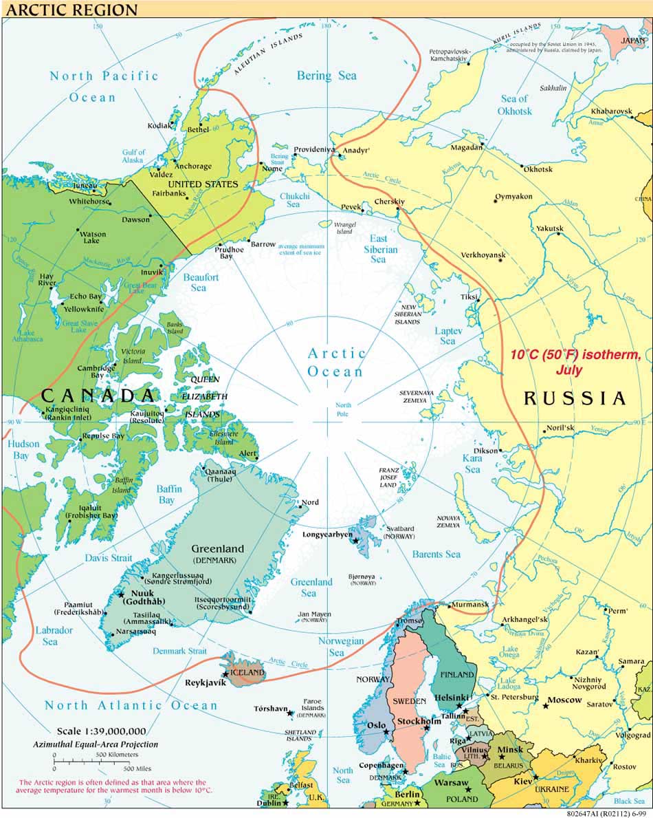
August 2010 was an active month for Canadian policy developments in the Arctic. In keeping with this blog’s July 2010 report on numerous U.S.-related arctic news items for that month, here is a short form update on significant Canadian announcements, projects and decisions in August affecting the Canadian Arctic.
Prime Minister Stephen Harper used his five day visit to the Arctic, from August 23-27, and the run-up to that visit, to unveil several Canadian initiatives, including the Canadian national policy on the Arctic.
August 20, Ottawa: Canada releases its Arctic Policy, formally titled “Statement on Canada’s Arctic Foreign Policy,” which elaborates on the international component of Canada’s Northern Strategy announced in 2009.
August 26: Harper announces that his government will establish the Tarium Niryutait Marine Protected Area in the Beaufort Sea, as part of an effort to conserve Beluga whales. For background on the Tarium Niryutait MPA and on the Beaufort Sea Large Ocean Management Area visit the Beaufort Sea Partnership.
PM Harper’s visit also coincided with:
The August 26th completion of a Canadian Coast Guard training exercise on environmental emergency (oil spill) response in Resolute Bay, Nunavut.
The exercise was part of Canada’s larger annual military training exercise in the North, “Operation NANOOK”. Danish and US forces participated in the operation for the first time this year.
Other relevant August 2010 developments for the Canadian Arctic:
August 8; Nunavut judge issues an injunction stopping a science expedition’s seismic operations from the R/V Polarstern in Lancaster Sound.
August 25: Canadian Air Force shadows Russian bombers in international airspace north of Inuvik.
August 29: Parks Canada announces completion of the 2010 Arctic Survey.
August 30: The Bahamanian-flagged Clipper Adventurer cruise ship runs aground on uncharted* rocks in the Northwest Passage; Canadian Coast Guard evacuates passengers to Kugluktuk (Update Sept. 8: *subsequent reports indicate that the hazard was known and that the the Canadian Hydrographic Survey had informed the shipping industry of the rock's location in 2007). Outdated charts appear to have contributed to the August 8 grounding of the fuel resupply vessel the Mokami near Pangnirtung and the September 2 grounding of the fuel tanker Nanny (Canadian flagged) on a sandbar in Simpson Strait; neither vessel suffered any reported loss of its cargo (the latter ship carried 9.5 million liters of diesel fuel).
Thanks to the Institute of the North and its Top of the World Telegraph , and to the U.S. Arctic Research Commission Arctic Update for reporting earlier on many of the sources drawn on here.


