Sunday, September 14, 2008

#19 Conflict in the Arctic? The Tenacity of Media Spin

Just hours after I returned, a week ago, from my trip to the Arctic Ocean, I was dismayed to open the New York Times and find on its editorial page hyperbole verging on that which other 
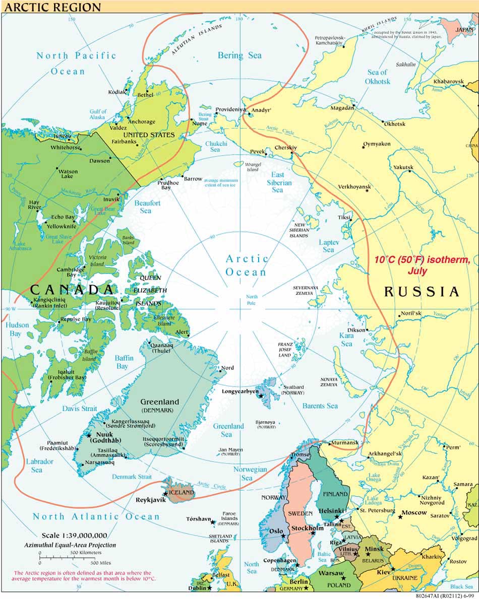
media sources use to perpetuate the myth of "fierce disputes over territory and natural resources" in the Arctic. ("Arctic in Retreat", September 8, 2008). As the sea-ice retreats, states are turning not to arms but to existing legal structures and a tradition of scientific and
 and 
diplomatic cooperation to address common problems as well as dis- agreements.

A helicopter from the Canadian icebreaker, the Louis Saint Laurent, on a friendly visit
to the USCGC Healy

Immediately after transporting our mapping crew to shore last week, The Healy turned right around and began breaking ice for a Canadian icebreaker, the Louis Saint Laurent. This month-long joint mission to map parts of the Arctic Ocean floor is scientific and diplomatic cooperation at its international best. Like the Russian mapping the NYT mentions in its editorial, the US and Canada are gathering data in preparation not for conflict but for submission in a staid and stable legal process designed to provide certainty for all states involved.  The Law of the Sea Convention establishes this orderly mechanism of rigorous scientific vetting for states seeking to extend their authority over larger portions of the continental shelf.  The United States is the only Arctic state not party to the Convention but is nonetheless mapping for its potential shelf extension in keeping with procedures agreed by the international community.

The territorial disputes referenced in the NYT editorial are also resolved not by conflict
but by diplomacy. In June 1990 Russia (then still the Soviet Union) and the United States signed a brilliantly conceived single maritime boundary treaty that precludes the need to renegotiate the boundary once the extended continental shelf limits are determined. Canada’s recent announcement that it plans to extend enforcement jurisdiction from 100 to 200 miles beyond its shores should raise concern.  But it must also be viewed within the context of the long-standing friendship and shared interests of the United States and Canada on such matters as environmental protection, trade (ca. $1.5 billion daily) and common security.   Their disagreement over the Northwest Passage has never flared out of control and continues to be the subject of diplomatic attention.

Other existing legal and diplomatic structures provide an imperfect but solid basis for Arctic states to resolve potential disagreements. The Arctic Council is a cooperative forum for states and the Inuit Circumpolar Conference to address a range of environmental and economic problems in the region. The Ilulissat (Greenland) Declaration, signed in May 2008, confirms the will of the five coastal Arctic states – Canada, Denmark, Norway, Russia and the United States – to strengthen existing cooperation based on mutual trust and transparency. Treaties in force in the Arctic cover issues ranging from polar bear protection to pollution by dumping from vessels to biological diversity. Activists and diplomats alike should be concerned and asking hard questions about whether these agreements will be sufficient, or sufficiently enforced,to protect the Arctic, but to pretend that it is a lawless region up for grabs ignores the facts.
Above: The USCG Cutter Healy and the Canadian icebreaker Louis St. Laurent
underway together in the Arctic Ocean earlier this week.


To be sure, the Arctic now faces enormous environmental and governmental challenges. Non-Arctic states are also legitimately concerned as to whether the Arctic countries will be good stewards of the Arctic’s immense resources. Having just spent three weeks surrounded by the unearthly beauty and light-filled vastness of the Arctic Ocean, I more than endorse the New York Times’ call for cooperation in face of the potential for expanded resource exploitation, environmental degradation and security risks as the ice melts. But to characterize the Arctic as a “scene of commercial and territorial conflict” overstates the case. Perversely, it also contributes rhetorically to escalating tensions rather than under-girding the very cooperation that the paper advocates.

Thursday, September 11, 2008

#18 September in Barrow - Return to Land


The LOS mapping crew disembarked USCG Healy on 5 September after three weeks at sea, escaping the worst of quite a storm that was brewing to our north off of the Russian coastline. Just as at the start of the trip, we were transferred by helicopter between ship and shore to the North Slope Borough Search and Rescue hangar in Barrow, the northernmost town in the US.

Barrow, AK is home to over 4,000 people and to the BASC - the Barrow Arctic Science Consortium.   With funding from the National Science Foundation's Office of Polar Programs, BASC encourages and provides logistical support for Arctic research.   Its research and education initiatives pertain to Alaska's North Slope, the Arctic Ocean off of the North Slope, and Chukotka, Russia.  BASC is the successor in a line of institutions that began with the Naval Arctic Research Laboratory founded by the Navy in 1947, although the US research presence in Barrow traces sporadically back to the late 19th century.


Above: accommodations the last night in Barrow: luxury quonset hut on the BASC campus

BASC shares it main building a few short miles out of town on one of Barrow's dirt roads, with the local community college, Sivunmun Ilisagvik Arctic College, and the Mayor's Workforce Development Programs.  Ilisagvik is a two year tribal college "dedicated to perpetuating and strengthening Inupiat (Eskimo) culture, language, values and traditions.

The Arctic Summer was nearing its end as we returned to Barrow.  The tundra was turning to shades of reds and heather, a fall foliage beautiful in its own spare way.


Monday, September 8, 2008

#17 Dredging


Dredging!

September 3, 2008

An ocean mapping cruise is mostly about forward motion, trying to map as much territory, around the clock, as time allows. But other projects on board require us to stop from time to time (see, e.g. my entry #12 about the on-ice deployment of a NOAA/National Ice Center buoy). We have spent the last few days of the trip dredging at various sites to get a sense of what kinds of rocks are in different parts of the ocean. Getting the rocks is really only the beginning. From here they will be taken back to various campuses for analysis under the careful eye of a few geologists. Their analyses will contribute to the larger picture of what the Arctic Ocean floor is made of and how the ocean basin was formed.

Kelley Brumley (in pink hard-hat), our fantastic on-board tectonic geology scholar, led the rock end of the dredging effort with the help of Healy's Marine Science Technicians (see entry #9), Dale Chayes of Columbia's Lamont-Doherty Earth Observatory and Alex Andronikov (blue hard-hat) a volcanics expert from the University of Michigan Department of Geology. The actual dredging requires much planning and logistical coordination:
- Identifying the right dredge sites based on sparse mapping of the region,
- Finding the actual site and hoping there is not too much ice over it,
- Breaking any ice that is there,
- Conducting a drift test which helps with the next step,
- Keeping the boat stationary over the site for the two to three hours it can take to run a dredge two to three thousand meters down and haul it back up,
- Properly preparing and securing the dredge, which weighs 700 pounds empty! (it is not uncommon to lose them if they snag on some unseen formation hundreds or thousands of meters below).
- Briefing all participants, and ensuring their safety (keeping non-essential personnel clear of the fantail for the hour or two that the dredge needs to pulls up its load under very high tension).
- Once the dredge is hauled back up, weigh the contents, which can be over a thousand pounds! Lots of mud involved ---
- Hope for more rocks than mud,
- Once the crane empties the dredge onto the fantail, start hosing down the pile and sorting the rocks. This involves lots of water in cold temperatures, bending, kneeling, lifting bucket after bucket of rocks, drying them and transporting them into the lab for cataloging…

The picture below shows the safety attire (and proves that I am earning my keep – that’s me under the yellow hard hat, happy as a geologist in mud).

#16 Polar Bear II


Bear Number Two, photos by Adriane Colburn

September 2, 2008

Number of Polar Bears seen on the Healy cruise in August 2007 = 21
Number of Polar Bears seen on the Healy cruise in August 2008 = 4


This comparison is nothing more than an anecdote, an observation, but still sits somewhat uncomfortably. [If you’d like more on polar bears, please see my earlier entry # 8 on the topic.] We also saw very few seals this year. Think food chain: where there are seals -- and ice -- there are bears. Fewer seals, fewer bears.

Three of the bears spotted this cruise were seen in the wee hours, one of those for only a fleeting moment; the fourth, spotted on September 2, was seen at a time when most of the crew was awake. The bear also remained in sight for quite a while.

It was fascinating to watch the bear sniffing for prey, poking its nose into the water, testing different routes between the ice islands and open water it encountered. I’ll be bringing back a short film of the bear produced by the NOAA videographer traveling with us, David Sillicorn. For now, here are two still shots of this gorgeous animal. The picture in my mind's eye is all of us standing on the bow in collective awe, really, watching the bear wend its way across the ice scape.

Icebreaking into the Arctic

The USCGC HEALY embarked Barrow, Alaska, in August 2008 to map the US extended continental shelf, or ECS, in the Arctic Ocean (HLY 0805). Healy sailed again from 7 August to 16 September, 2009 (HLY 0905) to continue ECS mapping, joining with the Canadian icebreaker, the Louis S. St.-Laurent. The two vessels mapped together again in 2010 (see HLY1002) and 2011 (HLY1102).

As the only law professor on the science crew, I was along on HLY 0805 and 0905 to better understand
the science behind the legal process that the UN Convention on the Law of the Sea establishes for states making ECS submissions. As to why the US is mapping now, even though it has not yet acceded to the Convention, read on both here, and in the Law of the Sea notes below.

Thanks to
Vermont Law School and especially to Larry Mayer, Director of the University of New Hampshire's Center for Coastal and Ocean Mapping, for making my part in the trip possible.
Thanks, as well, to Adriane Colburn, for opening new windows on and for the deep.