Tuesday, September 1, 2009

A New Seamount

On the midnight watch we passed again by the seamount discovered last week:

Polar stereographic image (75deg N), 6X vertical exaggeration, measured in meters. For other images visit LDEO

To chart our course we combine information from a variety of maps and data sources. Very little of the historical information we rely on was produced with GPS or the kind of multibeam echosounder equipment we are mapping with on HEALY, which provides very detailed images of the areas being mapped. Thus, last week we had only a previous contour line to indicate that a small rise might protrude from the seafloor in that spot. The earlier maps gave no indication that the feature would rise more than 1,000 meters or .6 miles from the seafloor, which is required for a seamount. Christine Hedge, the NOAA Teacher at Sea (from Carmel Middle School, Indiana), was standing watch when she noticed a feature emerging somewhat starboard of the planned ship track, and contacted the scientists in charge who redirected the ship so we could map the feature more completely.

While the seamount rises almost 1,100 meters from the seafloor, its peak is still over one and a half miles below the surface of the ocean (rising from 3710 meters to 2622 meters; the 3791 mark shown in the image above refers to the surrounding seafloor, not to the base of the seamount itself). It is located at 81 degrees 31.57N 134 degrees 28.80W, is approximately 14 nautical miles long, 4 nautical miles wide, and oriented N-S. Other images of the seamount may be found at the Lamont Doherty Earth Observatory of Columbia University.

Larry A. Mayer and Andy Armstrong, of the UNH Center for Coastal and Ocean Mapping/NOAA Joint Hydrographic Center, co-chief scientists for HLY0905, were also leading a mapping cruise on board USCG HEALY in 2003 when the feature now named Healy Seamount (after the vessel and its namesake, Captain Michael Healy) was discovered at 78º40’N, 158º 00’W.

Of the new seamount, Mayer says, in Andrew Revkin's DotEarth report:

"The new seamount is small but unusual in its isolation (at least we think it’s isolated — remember we didn’t know it was there - and I suspect there are many others that we don’t know about) — but this one is sitting in the middle of nowhere in the abyssal plain and will only add to the mysteries of the origin of this part of the Arctic."

Source: NYT DotEarth, September 10, 2009


Monday, August 31, 2009

Operating in Tandem

A year ago, on the HLY0805 leg of Arctic Summer West, after three weeks we had completed our mapping for the summer and were preparing to pack up and disembark. This year, as we enter our fourth week on board HEALY for 0905, we still have the luxury of two and half weeks to continue our work with the Canadian LOUIS S. ST-LAURENT. I continue to marvel at how different one day is from the next, even as we keep a routine watch and regimented daily schedule. And even as the weather has been an almost unbroken string of fog-filled days and nights. Visibility waxes and wanes, but a number of you following the photos on the Aloft Con camera (see link upper right) have commented on the, well, “consistency” of our weather.

Left: The Louis S. St-Laurent seen through the fog

The weather is in stark contrast to the brilliantly clear, light-infused days of HLY0805 and is revealing a different – and evidently more typical – picture of August weather in this part of the Arctic Ocean: fog and more fog, snow, some rain, sleet and, more rare, hoar frost. Tookaq Neakok, the community observer from the North Slope Borough who also traveled with us last year, says his family back on shore is reporting rain in Barrow. Ice conditions have been generally acceptable for mapping (you can see our tracks using the upper right links) both near the Chukchi Cap and across the Canada Basin, northward to our northernmost point on 2009-08-28 (roughly 122º70’044 W 84º22’211 N). Nonetheless it has been especially useful on the northern portion of our joint track to have the ability to break ice for one another.
Helo transfers of Coast Guard and scientific crew between ships have also been fruitful.

Friday, August 14, 2009

How Geoscientists Think - and Lawyers

The Louis S. St. Laurent and the Healy are now underway together, having rendezvoused on August 10th. Three members of the Healy science crew are blogging on day-to-day science operations on board: Barbara Moore, for the Extended Continental Shelf Interagency Task Force, Christine Hedges, a NOAA Teacher at Sea, and Jon Pazol for the Armada Project.

Being surrounded again by marine geophysicists is a good reminder of the ways in which our different disciplines see the world. An excellent piece in the August 4, 2009 EoS, How Geoscientists Think and Learn (and the Supplementary Material published online) is especially illuminating with respect to how their spatial and temporal perceptions differ from the general population, emphasizing perceptions of geological time, spatial thinking and understanding of complex systems. The piece is one result of the Synthesis of Research on Thinking & Learning in the Geosciences Project, Kim Kastens, Lamont-Doherty Earth Observatory and Cathy Manduca, SERC, Carleton College, PIs.

Lawyers and legal academics are also building on developments in cognitive science, but more to investigate its implications for legal and social policy than to understand how lawyers themselves think (perhaps even this difference in how the two disciplines use cognitive science says something about our view of the world and our roles in it?). The Project on Law and Mind Sciences at Harvard Law School's Berkman Center is self-described as a resource for those “with an interest in understanding the implications of social psychology, social cognition, and other related mind sciences for law, policymaking, and legal theory.” Also of note is Law, Mind and the Brain, by Michael Freeman and Oliver Goodenough, a Law and Mind Project contributor and a Vermont Law School colleague, who investigates how cognitive science is changing Anglo-American approaches to responsibility.

Friday, August 7, 2009

In Barrow: One Year Anniversary; Forest Fires in Fairbanks; Recent Developments in Law, Science, Policy

Dear Readers,
Greetings from Barrow (more specifically from BASC and the Ilisagvik cafeteria), where we are preparing to transfer to HEALY today, for its 09-05 cruise. Many operations in and around Barrow have been delayed by forest fires near Fairbanks and the ensuing transport-domino effect up and down Alaska’s airways.
First, thank you for your enthusiastic support over the last year. You have visited from many places around the U.S. and the globe. Because my postings will become less regular once we are on board, and through mid-September when we are scheduled to disembark, I wanted to take time now to thank you for reading along since I began this weblog one year ago, as we embarked on Healy 08-05.
Over the next few weeks my focus will be more on science operations on board and less on the policy and news I have tried to emphasize over the past 12 months. However, I wanted to send one last short listing of links about important developments in the last week.
LAW
U.S. and Canada: As many of you know, Alaska’s Senator Mark Begich introduced seven arctic-related bills this week. As Institute of the North points out in its Top of the World Telegraph, the bills are called “the Inuvikput legislation after the Inupiaq expression meaning “the place where we live.” In Canada, “Bill C-3, an Act to amend the Arctic Waters Pollution Prevention Act, came into force on August 1, 2009, effectively doubling the area of Canada’s jurisdiction to enforce certain environmental and shipping regulations, from 100 to 200 nautical miles.
SCIENCE
With the late summer /early fall arctic research season in high gear, more stories about potential effects of global change are making their way into the media. As always one needs to sort carefully through the range of reporting available online. I offer just one example, highlighted by the Knight Science Journalism Tracker, which dubs itself as offering “peer review within science journalism.” The Tracker questions aspects of report this week in the New Scientist feed that the Beaufort Gyre could contribute to exponentially increased pollution of the Arctic Ocean as temperatures warm and ship traffic increases. Not surprisingly, the blogosphere picks up the dramatic headlines without always questioning the conclusions.
POLICY
For readers not yet acquainted with the Federation of American Scientist project on Government Secrecy, I recommend its Secrecy News blog as an excellent source of information about data and declassification policies within the U.S. government. Recent posts include reference to the Department of Interior press release that “some 700 classified images of Arctic sea ice have been declassified and released.”
With thanks one last time from shore, I look forward to updating you from time to time between now and September 16 about life and work on HEALY 09-05. Barbara Moore of the US ECS Task Force as well as two teachers, Christine Hedge and Jon Pazol, will also be blogging from HEALY.

Icebreaking into the Arctic

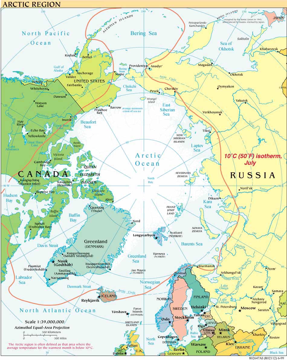
The USCGC HEALY embarked Barrow, Alaska, in August 2008 to map the US extended continental shelf, or ECS, in the Arctic Ocean (HLY 0805). Healy sailed again from 7 August to 16 September, 2009 (HLY 0905) to continue ECS mapping, joining with the Canadian icebreaker, the Louis S. St.-Laurent. The two vessels mapped together again in 2010 (see HLY1002) and 2011 (HLY1102).

As the only law professor on the science crew, I was along on HLY 0805 and 0905 to better understand
the science behind the legal process that the UN Convention on the Law of the Sea establishes for states making ECS submissions. As to why the US is mapping now, even though it has not yet acceded to the Convention, read on both here, and in the Law of the Sea notes below.

Thanks to
Vermont Law School and especially to Larry Mayer, Director of the University of New Hampshire's Center for Coastal and Ocean Mapping, for making my part in the trip possible.
Thanks, as well, to Adriane Colburn, for opening new windows on and for the deep.