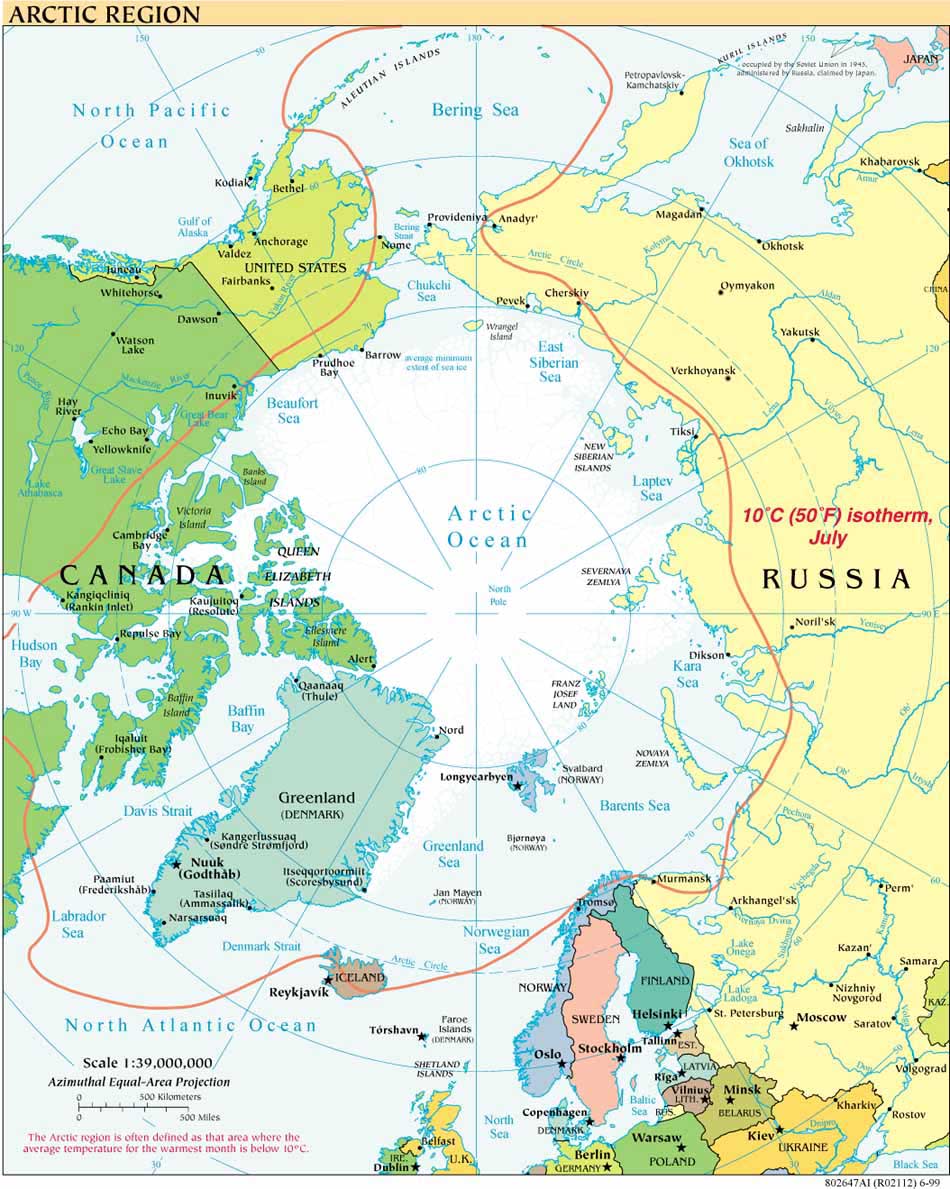
Let's start with some Arctic basics:
Can you name the eight Arctic States? For the complete list see below.
Where/what is the Arctic? There are many definitions. To quote the Smithsonian's Arctic Studies Center: "The Arctic Circle is technically everything above 66 degrees, 30 minutes North Latitude. However, other definitions rely on the presence of tundra vegetation, distribution of 'Arctic' animals like the walrus, the presence of permafrost, the temperature of the region or even the southern limit of pack ice during the winter." For more from this source, and some Arctic FAQs, see http://www.mnh.si.edu/arctic/html/resources_faq.html
What is the Arctic Council? A cooperative forum, not an international organization, in which the Arctic States and the Inuit Circumpolar Conference and other entities address areas of common concern- see http://arctic-council.org/section/the_arctic_council
How does the Arctic differ from Antarctica, beyond having polar bears rather than penguins?: Antarctica is governed by a unified treaty regime; the Arctic is not. Consensus appears to be growing -- see, e.g. the May 2008 Ilulissat Declaration --
that the Arctic does not need a new, comprehensive treaty because a range of existing treaties and binding agreements combine with existing "soft law" instruments to offer sufficient structures and norms to address the most important arctic issues.
For the kids (and others) to test their knowledge of arctic fundamentals, visit EducaPoles, the educational site of the International Polar Foundation.
That's it for starters. As to the eight states in question, they are Canada, Denmark, Finland, Iceland, Norway, Russia, Sweden and the United States.
Arctic Policies and Declarations
- Arctic Strategies and Policies: Inventory and Comparative Study (NRF, L. Heininen)
- Geopolitics in the High North: National Arctic Strategy Documents
- Arctic Policies: Regional and National
- A Circumpolar Inuit Declaration on Sovereignty in the Arctic 2009
- A Circumpolar Inuit DeclaratIon on Resource Development Principles in Inuit Nunaat 2011
- Ilulissat Declaration 2008
- Arctic Governance Project
- Ron MacNab, "A Tale of Two Cities: Washington, Ottawa, and Arctic Governance" (p. 22-28) CPC 2009
Icebreaking into the Arctic
The USCGC HEALY embarked Barrow, Alaska, in August 2008 to map the US extended continental shelf, or ECS, in the Arctic Ocean (HLY 0805). Healy sailed again from 7 August to 16 September, 2009 (HLY 0905) to continue ECS mapping, joining with the Canadian icebreaker, the Louis S. St.-Laurent. The two vessels mapped together again in 2010 (see HLY1002) and 2011 (HLY1102).
As the only law professor on the science crew, I was along on HLY 0805 and 0905 to better understand the science behind the legal process that the UN Convention on the Law of the Sea establishes for states making ECS submissions. As to why the US is mapping now, even though it has not yet acceded to the Convention, read on both here, and in the Law of the Sea notes below.
Thanks to Vermont Law School and especially to Larry Mayer, Director of the University of New Hampshire's Center for Coastal and Ocean Mapping, for making my part in the trip possible.
Thanks, as well, to Adriane Colburn, for opening new windows on and for the deep.


